TEXTILES.ORG
Company:
Propex
Project Details
Fabric 1
Armormax
Producer/Manufacturer:
Propex Geosynthetics
Primary Use:
Secondary Fabric
Fabric 2
Scourlok
Producer/Manufacturer:
Propex Geosynthetics
Primary Use:
Main Fabric
Engineer Name 1
Brain Meyers
Project Manager Company
Coleman Moore Company
Please describe the project specifications
The Sioux City Natural Resource Conservation Service (NRCS) wanted to stabilize the Des Moines Riverbank to prevent further erosion and flood impacts. The design goal was to restore the channel back to its 2006 alignment. The NRCS provided design criteria that protection would be needed for whichever was greater between ½ of the height of the bank or the 5-year storm event. The bank was measured to have a maximum height of 16-ft. Therefore, for this design, the 5-year storm event depth of 10.79-ft controlled the portion of the slope that would require protection.
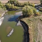
Additionally, the project had environmental considerations. The project site is regulated by the Iowa Department of Natural Resources, which is responsible for managing fish and wildlife programs, ensuring the health of Iowa’s forests and prairies, and providing recreational opportunities in Iowa’s state parks. Per IA DNR, several threatened and endangered species including birds, fish, insects, plants, and reptiles are located in Palo Alto County. Allowing erosion of the stream banks in the project area to continue could eventually impact the threatened and endangered species and the downstream West Fork Wetlands. Additionally continued sediment deposition could lead to lower water quality, habitat alteration and potentially result in this section of the West Fork being placed on future 303(d) list of impaired streams. Initially, the project engineer considered using rock riprap, but recognized that it does not provide a nature-based solution.
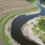
The West Fork of the Des Moines River cuts diagonally through Palo Alto County, providing drainage for approximately 1,800 square miles of farmland. Two roadways intersect along this section of the river and are connected by the Kirby-Flynn Bridge, a historic pin-connected Pratt high-truss bridge dating back to 1881. During rain events, the River would often flood in this area, causing erosion on an upstream bend and flood waters to inundate the bridge, resulting in an over 24-mile detour for local travelers.
From 2006 to 2019, the riverbank had receded up to 215 feet in the middle of the bend. Approximately three acres of soil had been lost during that timespan, and the receding shoreline was approaching an existing roadway.
What is unique or complex about the project?
To provide protection from both two and five-year storm events while simultaneously increasing erosion resistance, our company designed a unique configuration of ARMORMAX and SCOURLOK. Two SCOURLOK units were placed along the 2006 alignment to provide enough height to provide protection for the 2-year storm events, which occur more frequently. A 40-ft wide floodplain bench, protected by ARMORMAX, extended behind the first section of SCOURLOK to provide increased erosion resistance above the 2-year events. An additional SCOURLOK unit was placed at the edge of the 40-ft floodplain bench to provide protection for the 5-year storm events. Finally, the ARMORMAX system was utilized above the second tier of SCOURLOK to provide increased erosion resistance for the 5-year and 10-year events.
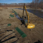
Installation of the bank stabilization solution began with the lower 1-1 section of SCOURLOK. Once the lower section was completed, the upper 1-unit section of SCOULROK was then installed, followed by the ARMORMAX system between the SCOURLOK sections. The contractor was able to use material from a sand bar to fill the SCOURLOK units, providing an efficient installation and minimizing the import of any fill or rock. The ability to minimize rock reduced the cost of materials transportation and lowered the carbon footprint by reducing transportation emissions.
“We feel the project will stop the severe erosion that had been occurring on the river bank and will save the bridge that would be in danger of washing out otherwise,” said Rick Hopper, Director of Engineering.
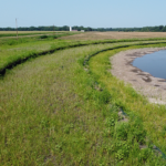
The SCOURLOK and ARMORMAX combination stabilized the Des Moines Riverbank and effectively reinstated the 2006 channel alignment. Additionally, the system provided reinforced vegetation, which will help decrease sedimentation and pollutants and encourages infiltration of water back into the groundwater table.
Since installation, the systems have been engaged several times during flow events, and are performing as designed. Their resilience and durability will allow for a long-term performance that will support the surrounding ecosystem.
Content is submitted by the participant. ATA is not responsible for the content descriptions of the IAA award winners.
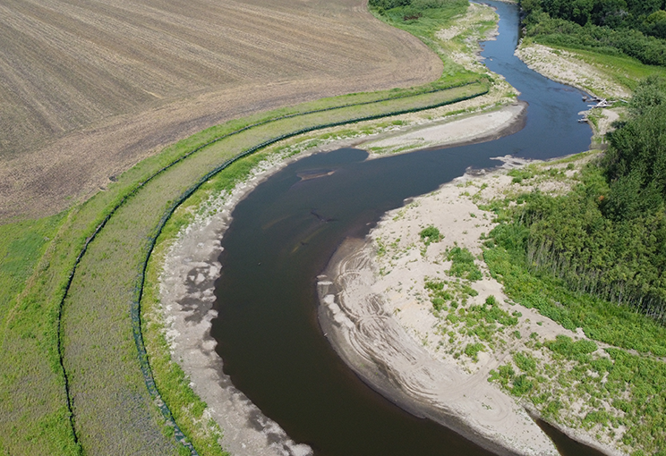
Palo Alto after restoration
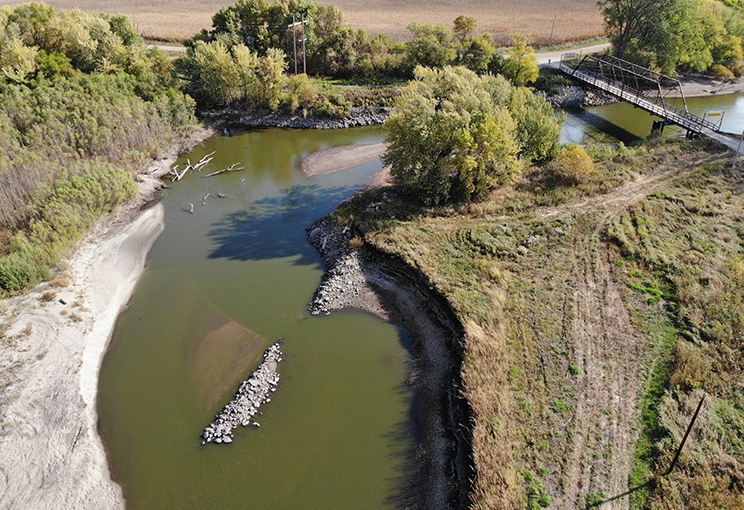
Palo Alto before restoration
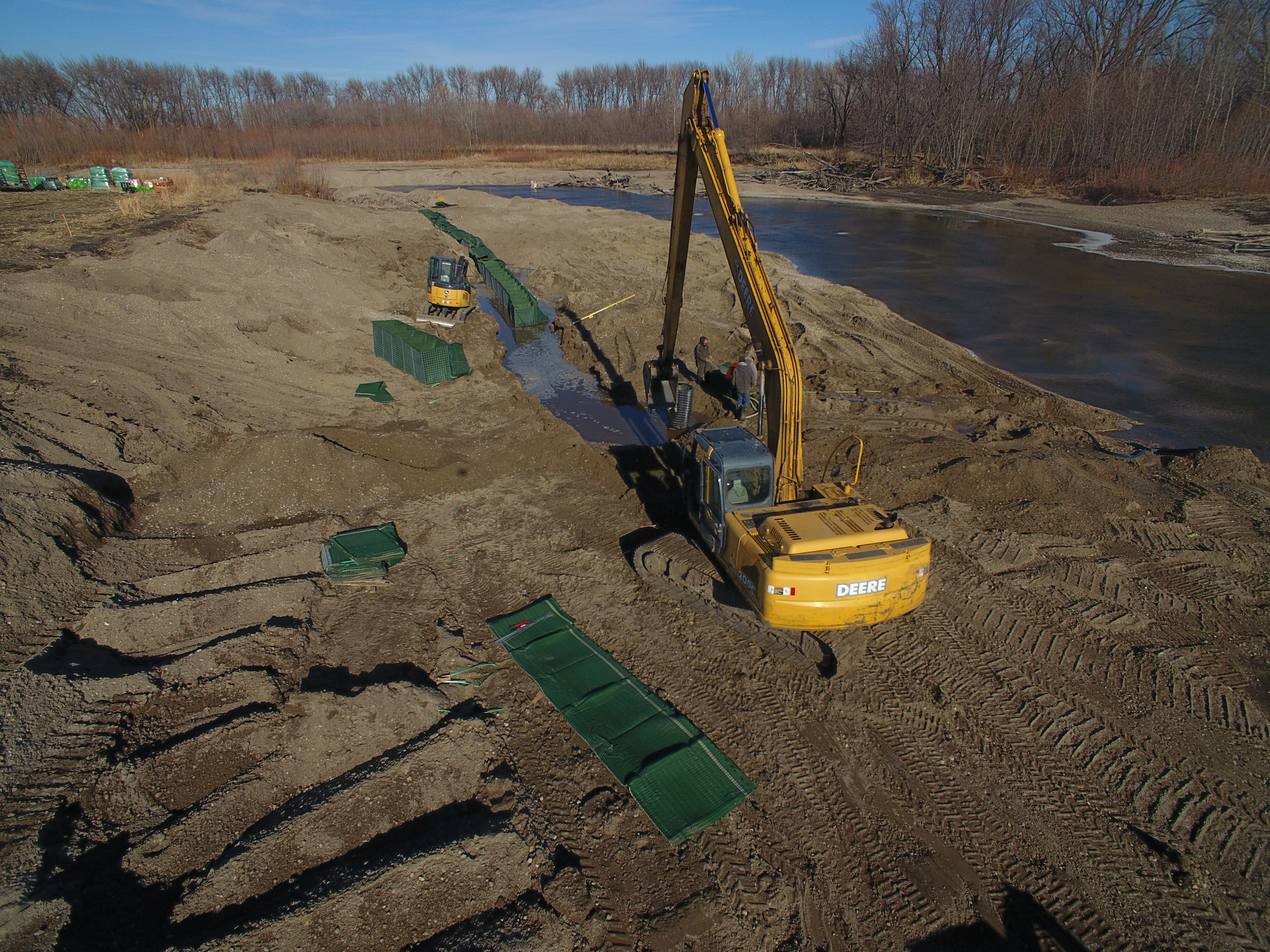
Installation
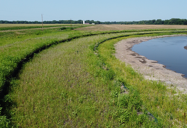
Vegetation